
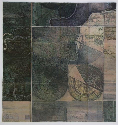
Jean Davey Winter
En Route 2
acrylic/mixed media on unstretched calico
36 x 35 in. (open)
We are all familiar with the various satellite mapping systems: GIS (Geographic Information Systems) and the regular GPS technology used in our cars, cameras and Smartphones.
Taking the format of the traditional folding map and combining it with found images from internet mapping sites, this series of work continues my exploration of travel, the journey and mapping. Although these images are derived from satellite photographs of actual places, through the processes of digital manipulation, collage and painting they have acquired a more personal interpretation, as a means of mapping elements of a projected journey.
In September I fly to Denver on the first stage of a journey to New Mexico. Although I obviously have no specific details of our flight path, from my research on the internet it seems likely that this is the kind of landscape we might encounter ‘en route’.
However, despite the benefits of such technology and our growing dependence on it, maybe we have to ask ourselves whether ‘the end justifies the means’. We are constantly photographed and monitored by satellites. We have no control over the use of this material, much of it freely available within the public domain to anyone with a computer and internet access. This raises the question of whether it is an invasion of our privacy and if so whether it makes us potentially vulnerable to the misuse of such information, or whether this is outweighed by the many benign uses to which it can be put.
© Jean Davey Winter